Date(s) of Creation
ca. 1910s-1990s
Physical Description
ca. 3100 physical maps
Scope and Content
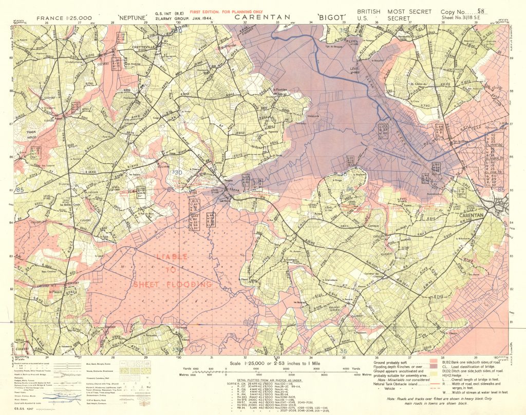
The Map Fonds contain over 3100 Topographical and Going Maps with Defence, Engineer, Flooding, and Geological Overprints, ranging from the 1910s to the 1990s. While the majority of the maps focus on Western Europe (France, Belgium, Germany, the Netherlands) during the Second World War, the collection also includes maps of North America, Italy, and China. The majority of the maps were created under GSGS (Geographical Section, General Staff, also known as MI 4), which operated under the Director of Military Operations and Intelligence in the British War Office during the Second World War. The GSGS collected data on foreign survey networks and provided training, supplied maps, and prepared survey data for the Allied forces.
The Map Fonds contain maps in the following Series:
- G.S.G.S. 2364 France 1:100,000
- G.S.G.S. 2738 France 1:250,000
- G.S.G.S. 2758 Europe 1:1,000,000
- G.S.G.S. 3868 Hong Kong and New Territory 1:20,000
- G.S.G.S. 3907 England & Wales 1:63,360
- G.S.G.S. 3961 Hong Kong and New Territory 1:80,000
- G.S.G.S. 4083 Netherlands 1:50,000 1940-1941
- G.S.G.S. 4040 France and Belgium 1:50,000
- G.S.G.S. 4041 France and Belgium 1:25,000
- G.S.G.S. 4042 Central and North West Europe 1:250,000
- G.S.G.S. 4072 Europe (Air) 1:500,000
- G.S.G.S. 4228 Italy 1:25,000 1943-1945
- G.S.G.S. 4234 France Town Plans 1943-1944
- G.S.G.S. 4250 France 1:50,000 1942-1944
- G.S.G.S. 4249 France 1:100,000 1943-1944
- G.S.G.S. 4336 Belgium & N.E. France 1:100,000
- G.S.G.S. 4346 Germany and Central Europe 1:250,000
- G.S.G.S. 4347 France 1:25,000
- G.S.G.S. 4411 France 1:25,000
- G.S.G.S. 4414 (Eastern) Holland and Germany 1:12,500 & 1:25,000
- G.S.G.S. 4416 Germany and Central Europe 1:100,000
- G.S.G.S. 4427 Holland 1:25,000 & 1:12,500
- G.S.G.S. 4507 Germany 1:50,000
- U.S. Chart Map France – North Coast 1:5,000
- Bird’s Eye France
- Misc. France, (Western & North West) Europe, Niederlands, Germany, Canada-United States, World, Holland 1:1- 1:6,400,000
Download the complete finding aid for the Map Fonds here: LMH Map Fonds Finding Aid August 2017.
For map guides for each G.S.G.S. Map Series, see McMaster University’s WWII Topographical map guides (https://library.mcmaster.ca/maps/ww2/ww2_topos_home), or click on the links below:


